1996 Summer Exhibit: "History of Greensboro - 1781-1860"
(as compiled by Thomas & Barbara Woodward)
In 1996, the Greensboro Historical Society organized an exhibit to characterize the first 100 years of the town. This page includes the town charter, early property and area maps, information about the Bayley-Hazen Military Road, and images with descriptions from the permanent Hill Family Exhibit. Below, please find a scrapbook of information that represents the exhibit at the GHS museum.
Click here for PDF of the
History of Greensboro
from 1781-1860
When: 1996 Summer
Where: Exhibit at GHS Museum and presentation at Fellowship Hall of the Greensboro United Church of Christ
Contents
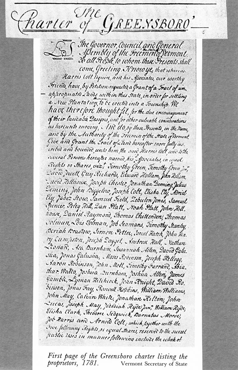
Greensboro Town Charter
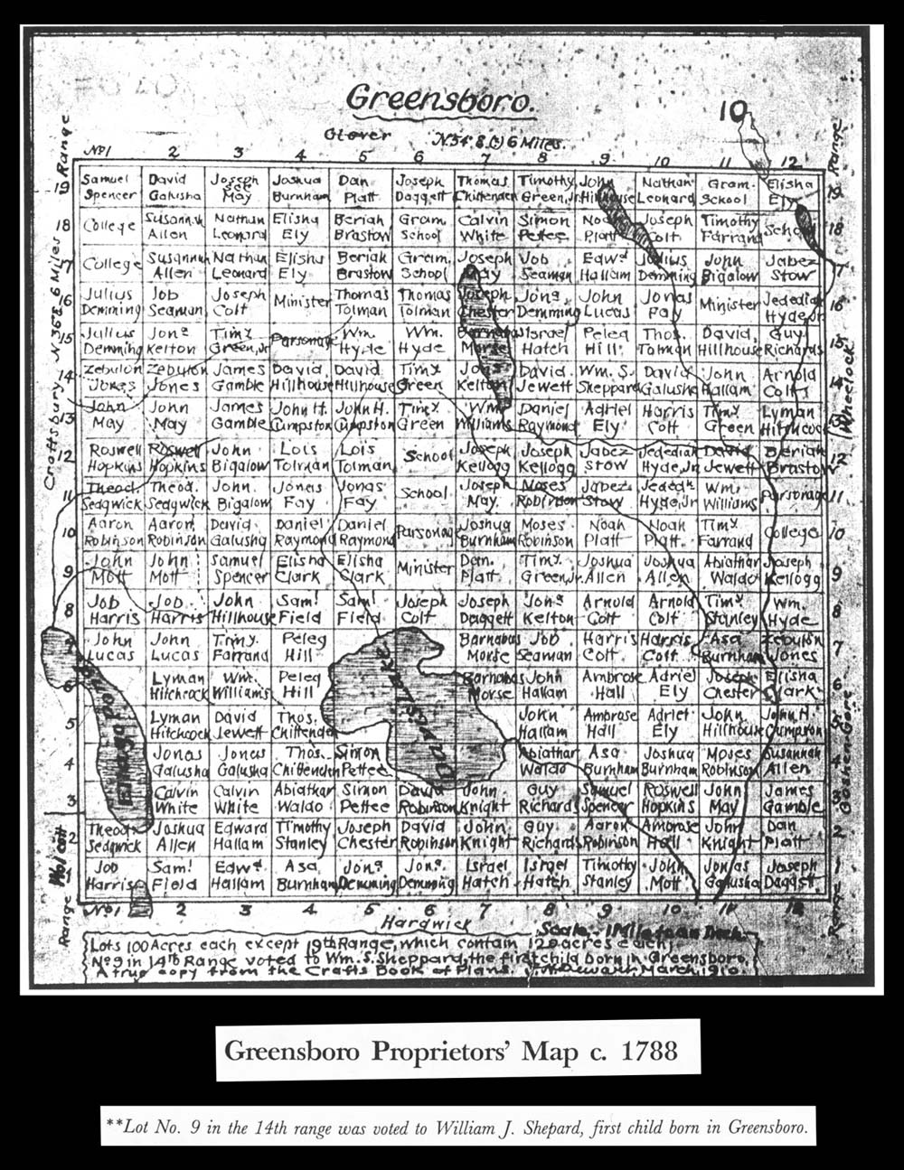
Greensboro Proprietor's Map circa 1788
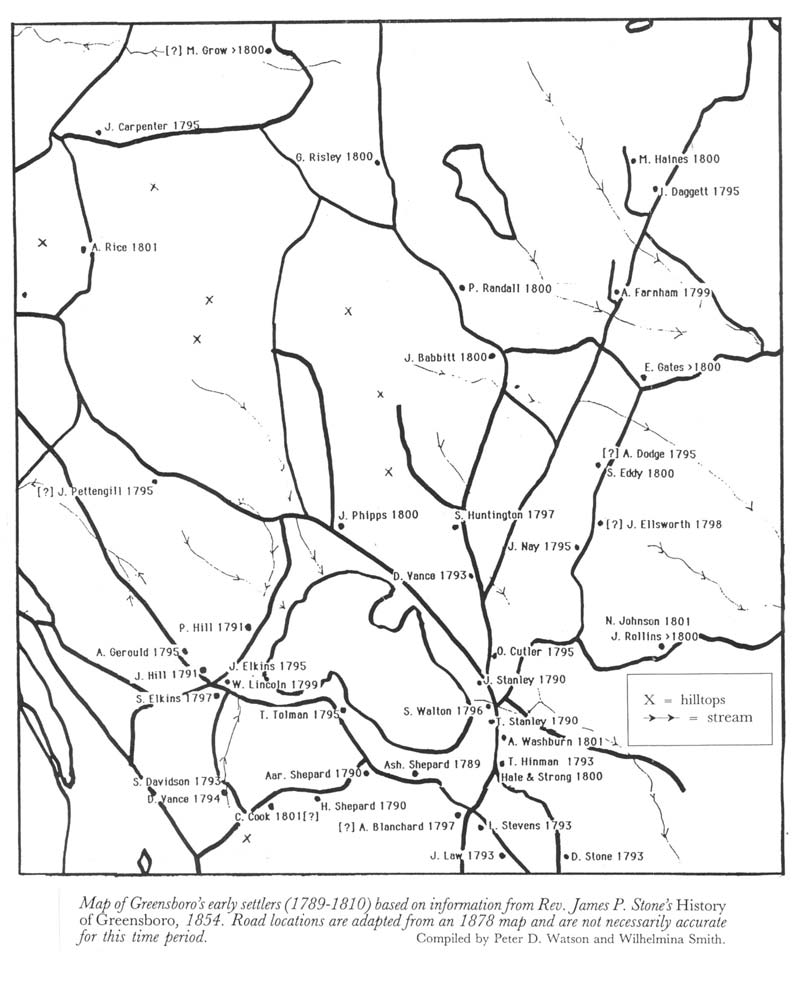
Greensboro 'Early Settlers' Map (1789-1810)
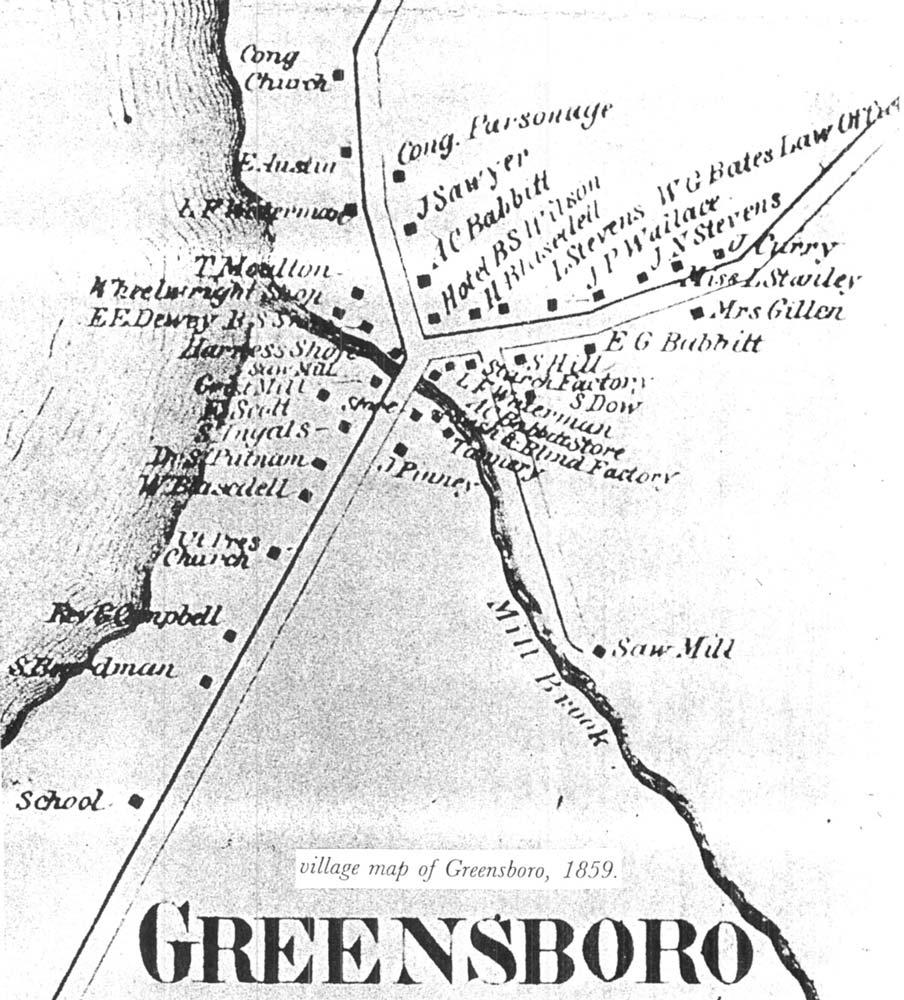
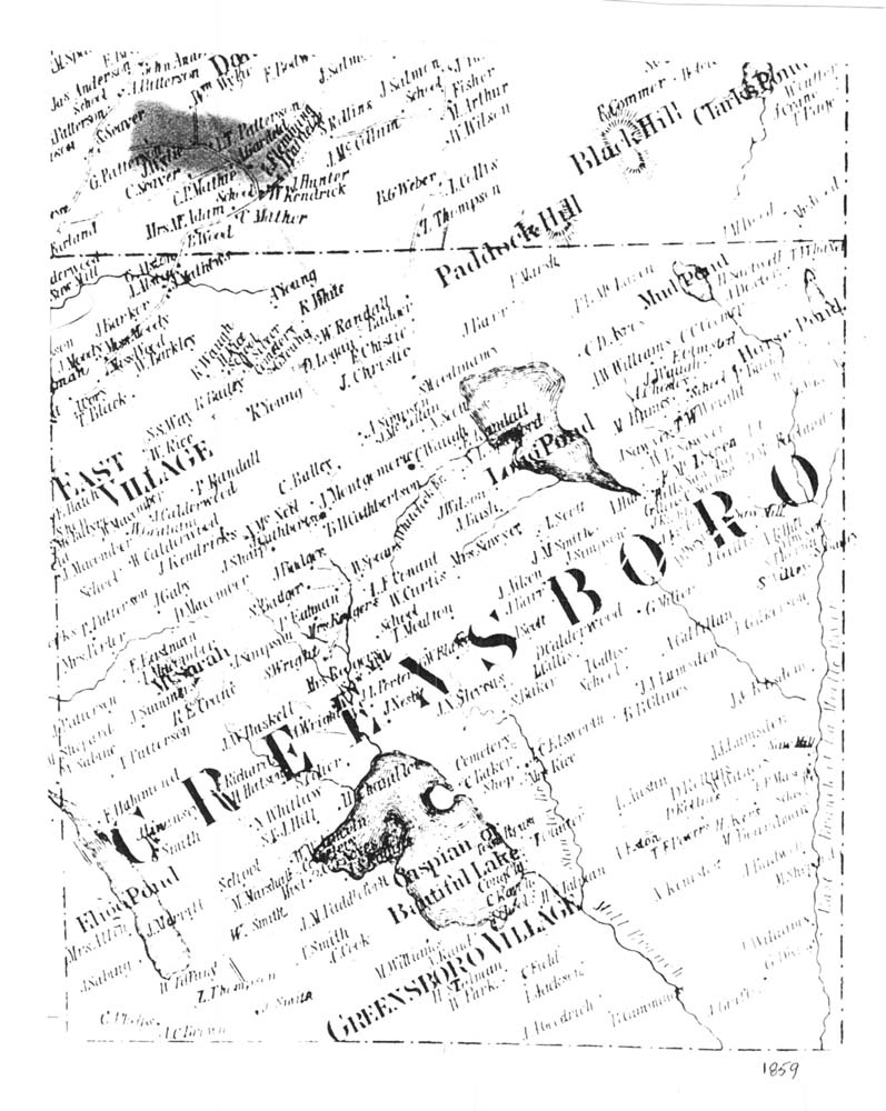
Greensboro Village Maps (1859)
James Whitelaw's 1794 map of Greensboro
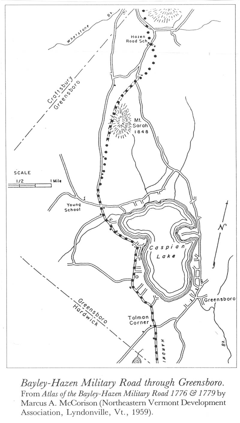
Bayley-Hazen Military Road
Hill Family Exhibit
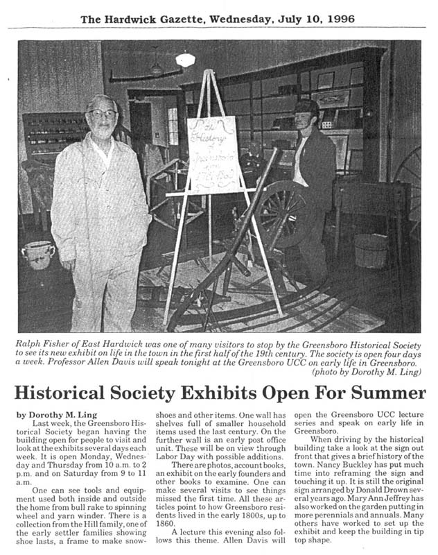
Hardwick Gazette Article about Exhibit
Greensboro Town Charter
Greensboro Proprietor's Map circa 1788
Greensboro 'Early Settlers' Map (1789-1810)
Greensboro Village Maps (1859)
 |
 |
James Whitelaw's 1794 map of Greensboro
Bayley-Hazen Military Road
- excerpted from the bicentennial history of Greensboro -
 |
THE BAYLEY-HAZEN ROAD During the French and Indian Wars (1756-1763) a series of military roads were built to facilitate the movement of men and materiel from Southern New England towards northern New England and Canada so that American troops would be in a better position to defend against the French army or its Indian allies. Southern New Hampshire had been fairly heavily settled by 1761 and a road had been build from Charlestown, New Hampshire, across Vermont to Crown Point on Lake Champlain. After the English victory in Canada and the start of the American Revolution, the enemy was no longer French but the English and their Indian allies. By the beginning of the Revolutionary War in 1776 settlers and some militery forces had moved as far north as Newbury, Vermont (settled in 1761) and Wells River. Benedict Arnold and Richard Montgomery had led an ill-fated campaign to capture Canada for the American forces in 1776. During that time, the head of the American or colonial militia in Vermont was Colonel Jacob Bayley of Newbury. Colonel Bayley felt that a road going north directly to Canada from the vicinity of Newbury would greatly shorten the route to Canada. He ordered one Thomas Johnson to lead a small party overland from Newbury to St. Johns on the Richelieu River in Quebec, blazing the trail as he went, and determining the distance involved. Colonel Bayley sent the report to General George Washington and urged him to support the building of the road. Bayley instructed James Whitelaw of Ryegate to lay out the route for such a road. Whitelaw, who was to become Vermont's second Surveyor General (Ira Allen was the first), must have already been familiar with the geography of northern Vermont since he had helped lay out the boundaries of its early towns. Bayley began work on the road in 1776 following Whitelaw's survey. With 110 men he built a road passable by wagon to a point six miles above Elkin's place in Peacham Village at a cost of 982 pounds. The men were paid the equivalent of ten dollars per month, board, and one-half pint of rum. |
But a series of military reversals in the north forced Washington to advise Bayley to abandon the project since there was now a serious threat that the enemy might use the road to invade northern New England. Bayley quit the road building project and, to add insult to injury, was repaid only about a quarter of his own investment. General Washington, with new plans for a Canadian campaign, ordered General Moses Hazen of Haverhill, Massachusetts, to resume work on the road in 1799 and to recruit his regiment for an attack on Canada.
Hazen extended the road to an area known as Cabot Plains and then to Walden, where he built blockhouses. Hazen then continued the road to Greensboro, where he erected a blockhouse on the western side of Caspian Lake similar to the ones he had built on Cabot Plains and in Walden. The road continued north past what is now Campbell's Comers and went straight up the hill curving around Mt. Sarah, running more or less parallel to the present road to East Craftsbury, entering that village on the other side of Cate Hill.
But news of troops retreating from Canada told of more military reversals in the north, and the blockhouses along the road, to say nothing of the settlers, who had come up as far as Peacham, felt themselves to be in precarious state, indeed. Small wonder that Hazen's men became discouraged: they were poorly clad, many without shoes. The flies were particularly bad that summer. Hostile indians and possibly English troops were rumored to be advancing. In October Hazen retreated to the south. and a company of militia from New Hampshire held the Peacham fort (12 miles north of Peacham).
Indian scouts who had been order'to hold the Greensboro blockhouse did not fare as well as others. Two of them, Constant Bliss of Thetford, and Moses Sleeper of Newbury were shot down and scalped. Their companions, having offered no resistance, were led captives to Canada and were later released in an exchange of prisoners. The remains of Bliss and Sleeper were later buried in an uncoffined grave.
The Bayley-Hazen Road was never extended beyond Hazen's Notch (in Montgomery) and was unsuccessful as a military road. It was, however, of great importance in the settlement of northern Vermont. The Town's first settlers, Shepards, Hills, Stanleys, and others came along it. It is possible that Colonel Bayley had this in mind when he asked George Washington for funds to build the road.
At the time of the Nation's bicentennial in 1976 the road was traced and marked in each township. Some portions follow existing roads but much of it is now overgrown hillside or swamp.
Hill Family Exhibit
Hardwick Gazette Article about Exhibit